Google Earth is an illusion: how I am using art to explore the problematic nature of western maps and the myth of ‘terra nullius’

Within western society, maps are often perceived as scientific, neutral and objective tools. Map making has always been shaped by our social and cultural relationships to the land. In the last 20 years, approaches to map creation have become much more reliant on photographic and digital technologies, including Google Earth.
However, these technologies carry a rarely acknowledged subjective and colonial agenda towards representing place.
My artistic exploration of western maps began during my honours year in 2020 and has since become a key part of my PhD research. Due to the pandemic, travel to Pitta Pitta Country was prohibited, therefore making it impossible for me to create photographs of Country for my project.
Pitta Pitta is located in western Queensland, 300 kilometres south of Mount Isa. My maternal great-grandmother Dolly Creed was stolen from Country as a young child and my family has been dislocated since. My understanding of this landscape is informed by oral history, and my relationship to it is shaped by my distance from it.
I grew up on Wadawurrung Country, an hour south from Naarm (Melbourne), and have lived in Victoria my whole life. Like many Aboriginal and Torres Strait Islander people, my understanding of self is scarred by the atrocities my family have experienced due to colonisation.
These experiences heavily inform my practice and research.
Read more:
Drawing data: I make art from the bodily experience of long-distance running
Relationships with Country
In response to COVID travel restrictions, I decided to go to Pitta Pitta “virtually” via Google Earth. While looking around Pitta Pitta via the street view function, I began noticing the inaccuracy of the technology. The images hadn’t been updated since 2007, the technology glitched a lot and, most importantly, there was no acknowledgement of Indigenous Custodianship.
I went looking for places I recognised on Country within Google Earth to see what had been photographed.
On the outskirts of Boulia, a small town on Country, a Waddi tree sits. Waddi trees are rare species of Acacia endemic to central parts of Australia. This particular tree was a significant gathering place for my people.
Within Google Earth it had been reduced to a blob of pixels, a dark shadow smeared on a reddish landscape. I was angered that Google decided this tree was unimportant, but also began to wonder why.
Responding to Google’s representation of the tree, Waddi Tree from my series (Dis)connected to Country aims to demonstrate where Google Earth has erased topographical information and Indigenous Knowledges of place.
My research addresses this gap. Waddi Tree layers a photograph I made of the tree during my last visit to Country in 2019 onto a screenshot from its location within Google Earth.
Through the omission of Indigenous Knowledges of place, western maps of Australia continue the false colonial narrative of terra nullius – land belonging to no one.
The photographic technologies used within Google Earth don’t allow, nor represent, the significant relationships Indigenous peoples have with Country. Photographic and digital images have also become intertwined with mapping in Google Earth. This changes how we relate to place, normalising a flattened and very limited view.
Read more:
An Ode To My Grandmother: remaking the past using oral histories, theatre and music
Glitches in time
Indigenous Knowledges of place are rooted in relationships which recognise that all forms of life have agency and are interconnected.
Put very simply, Country, all that it encompasses, and self are intertwined and valued equally.
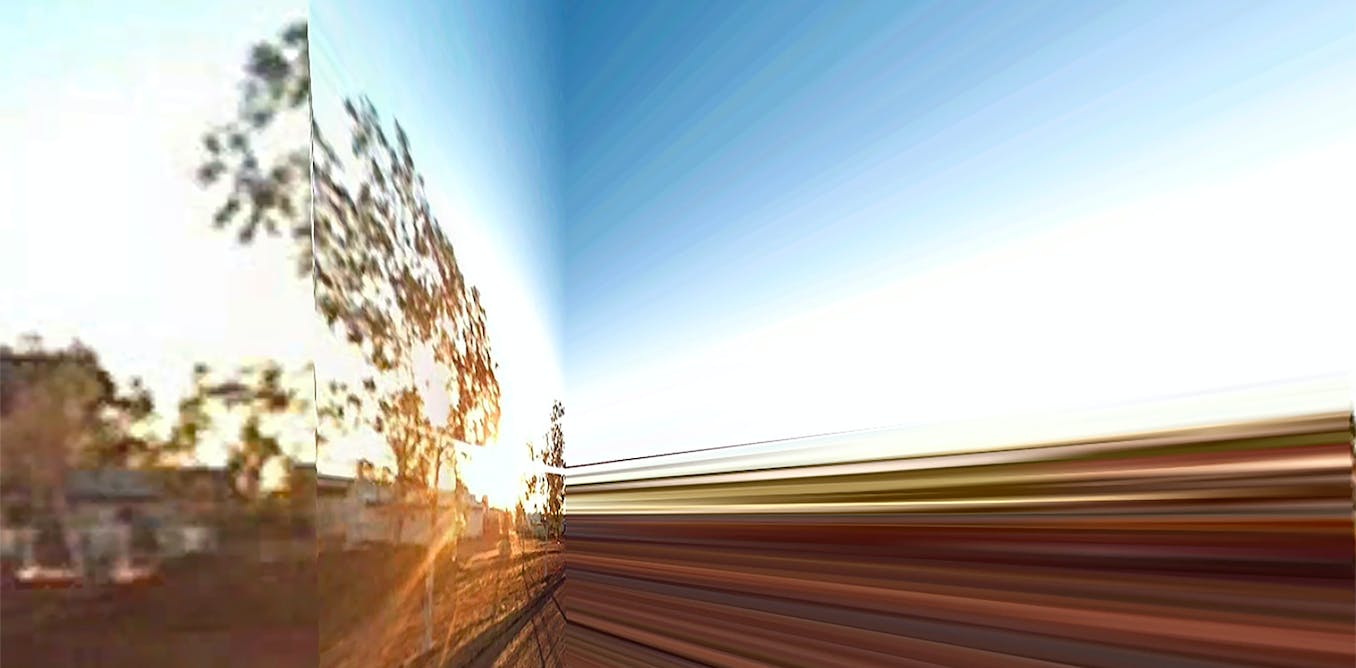
Other images from the series seek to identify where the technology dysfunctions and breaks down within itself. I like to think of these “glitches” as tears in the technological fabric of Google Earth, and therefore the narratives the technology enforces. Pitta Pitta (Google’s Earth) and Pitta Pitta (Published Without Permission) are freeze-frames from transitions between the aerial and street view functions which emphasise this glitch.
My research and arts practice are informed by my family history and my positionality as a Pitta Pitta woman.
I acknowledge my Ancestors and my great-grandmother Dolly whose story has shaped my family in unimaginable ways. Additionally, I extend my respects to the ongoing Custodians of the Kulin Nations where I work and live.
Sovereignty has never been ceded and it always was, and forever will be, Aboriginal land.
I’ll finish with a quote from Indigenous scholar Aunty Mary Graham:
There is no Aboriginal equivalent to the Cartesian notion of ‘I think therefore I am’ but, if there were, it would be – I am located therefore I am. Place, being, belonging and connectedness all arise out of a locality in Land.
Read more:
The air we breathe: how I have been observing atmospheric change through art and science
Jahkarli Romanis does not work for, consult, own shares in or receive funding from any company or organisation that would benefit from this article, and has disclosed no relevant affiliations beyond their academic appointment.


